Tools
|
World Atlas - source for maps and geography education - www.worldatlas.com/
This is a good resource which includes black line master maps to print and color. Physically making their own maps, having to pay attention to the details, was a good way to get students to focus on the physical and political regions of the world.
Why? Why did I introduce these sites to my students? Because I felt they really didn't know anything about the world beyond their own city, county, or state. They didn't even know the geography of their own country or where particular states and cities were.
I had traveled the world as the daughter of a career military man, and my view of the world was much different from students who had been limited in their contact with people outside of their own groups. With Hirsch, I think there are some things students simply should know. |
Sheppard Software has created a site I found very useful in helping students to learn the geography of different world regions, especially the countries there, through games. www.sheppardsoftware.com/Geography.htm
This site made learning fun. I gave credit to my students when they were able to correctly identify the countries in a region (like Europe) with at least 70% accuracy, and allowed them to try for a higher score.
How are students supposed to understand history or discuss geopolitical topics if they don't even know what is out there or where things are?
Remember the old man-on-the-street interviews (still ongoing) where random people are asked questions and look foolish when they don't know simple things? Why is that funny? That is not what we want for our own children or for students in our classes. This is knowledge they need to have and a foundation for understanding the complex interactions among people groups and nations. |
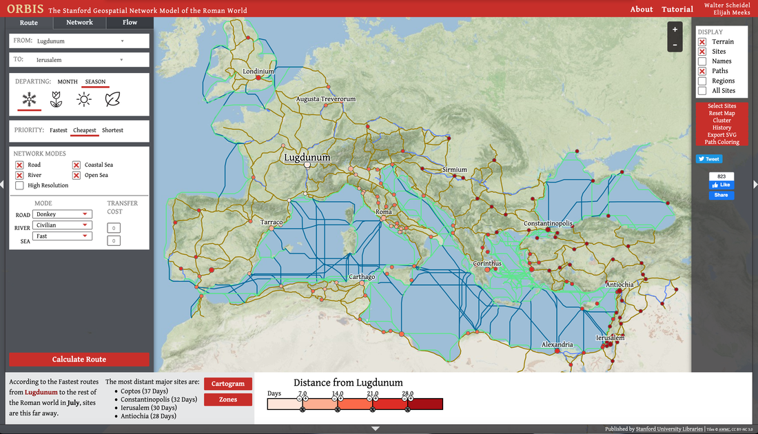
Interactive maps of the Roman Empire orbis.stanford.edu/ created by the people at Stanford University are a lot of fun and make understanding that time and place much more realistic. For example, one of the interactive maps allows you to plan a trip, choosing the time of year, cost of travel, and mode of travel. It really brings home how long it took people of that time and place to travel, how that would have affected trade, and what kinds of things people of that time had to deal with, even traveling in the Roman Empire, which for them was a pretty civilized place.